

Rose Hill
Abandoned NC&STL Railway
Route Between Memphis, Jackson & Bruceton
Rose Hill Station - Milepost NG 140.8
Click for enlargement
Phillips Road looking east. Old main line was on this way.
Click for enlargement
Phillips Road looking west. Old main line was on this way.
Looking north on Phillips Road. The railroad crossing signs still in
place in March 2008! Rails are still in pavement, about where the
white sign can be seen on left. Phillips "tees" into Beech Bluff
Road. A siding was here on south side of tracks, along north side
of factory that can be partly seen to the right. Photo and
contributed by Dennis Martin. 
Road bed a little east of Rose Hill, looking west. It runs to the
right of the trees in center of pic. (long shot). See zoomed in.
Photo and contributed by Dennis Martin.
Road bed a little east of Rose Hill, looking east. It runs to the left of
the big trees in center of pic. Driveway has been built up after tracks
removed (long shot). See zoomed in. Photo and contributed by
Dennis Martin.
Click for enlargement
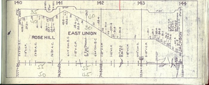
1913 NC&STL track diagram (updated circa 1930's). See legend for the abbreviations and symbols.
Click for enlargement
Topo map of Rose Hill on July 1, 1983 by TerraServer-USA.
Eric's
Homepage | Bridges
| Depot List
| Mystery Station
| Photos |
Railroad Museums
Route Maps | Station
List | Steam
#576 | Timetables
| Track Realignment
| Contact Eric
This page maintained by Eric C. Fleet.
If you have materials that you would like to contribute, contact
me at EricFleet@ncstl.com
